Heritage of the city
Thanks to its strategic geographical location and its remarkable natural potential, the city of Tangier enjoys a rich and varied archaeological and architectural heritage that constitutes an invaluable civilisational legacy, a material testimony to a distinct cultural identity based on the local substratum and enriched by Mediterranean contributions, and the result of a long process of urbanisation that the city has experienced throughout its history. This heritage, which represents an important part of the current urban landscape, is divided into three major entities:
The archaeological heritage
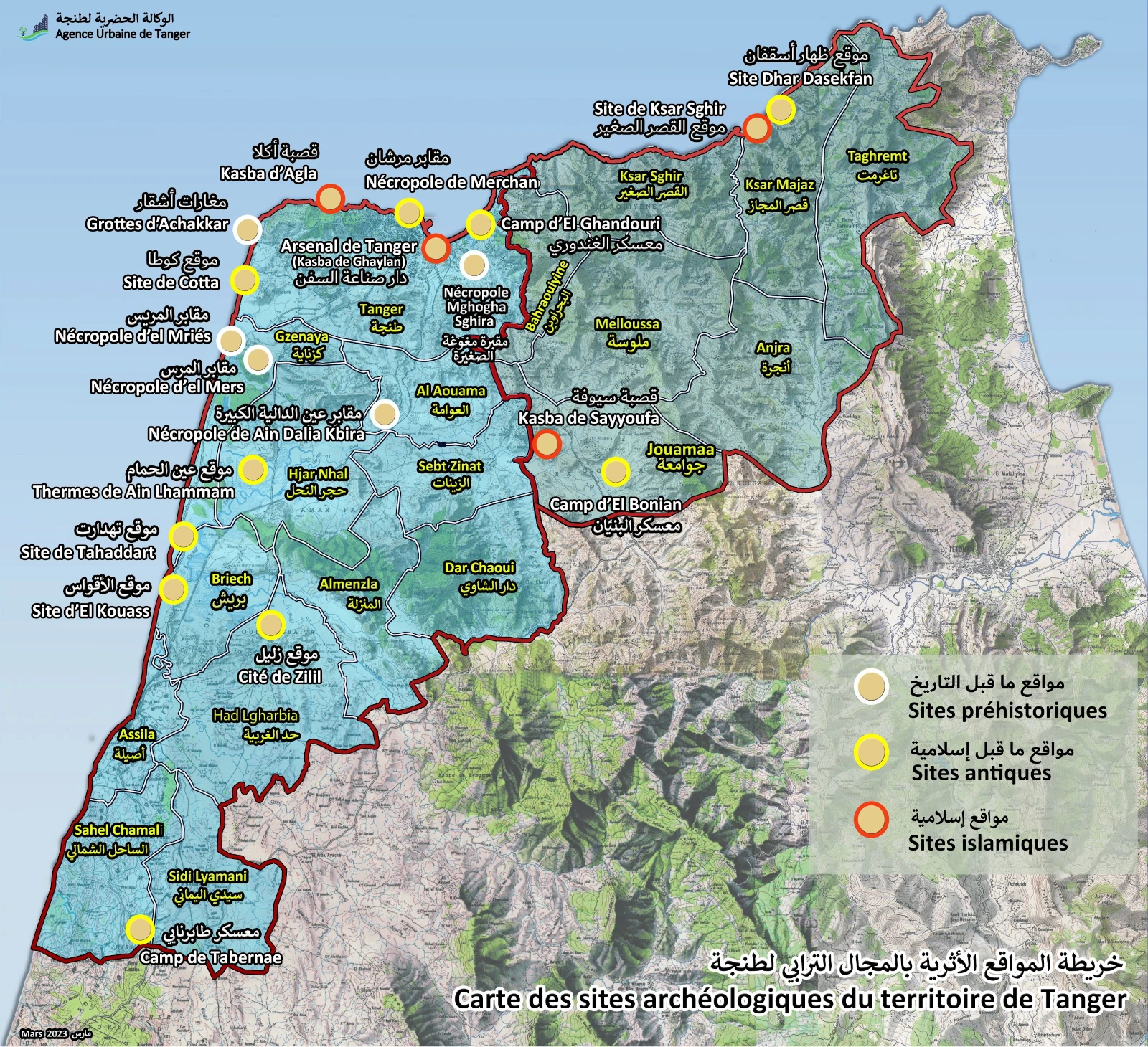
The archaeological heritage, spread throughout the territory of Tangier and jealously buried in its soil, dates back to the various civilisations (prehistoric, Phoenician, Roman and Moroccan-Islamic, etc.) that succeeded one another in the city. The prehistoric caves and the Roman site of Cotta at Achakkar, the protohistoric necropolises of El Mers, El Mriés and Dalia Kbira, the Roman necropolises of Merchan, the Roman military camp of El Benian on the road to Tetouan, and the ancient medieval arsenal of Tangier known as the "Kasbah of Ghaylan" at Malabata, represent only the witnesses of a far greater treasure buried in the various zones of the city.
The medina
The medina is the first nucleus of the city of Tangier. It constitutes a specific urban fabric that houses remarkable monuments dating from multiple historical periods, ranging from the Roman era, the first Islamic era with the arrival of Islamic civilisation in Morocco and the Moroccan dynasties (Idrisid, Almoravid, Almohad, Marinid and Saadian), the Portuguese era, the English era, and the second Islamic era with the recovery of the city under the Alaouite dynasty at the end of the 17th century. During this dynasty, the medina of Tangier resumed its military and diplomatic role, recovered its commercial activity as a gateway to the Mediterranean, and experienced considerable urban development and social flourishing. At the beginning of the 20th century, the medina of Tangier underwent remarkable transformations at the social and architectural levels with the establishment of the international regime, and the new city of European character then made its appearance thanks to an extra-muros urban expansion already initiated at the end of the 19th century.
The architectural heritage
The contemporary architectural heritage of the city of Tangier reflects the richness of forms and compositions prevailing during the period extending between the end of the 19th and the beginning of the 20th centuries, and translates the cosmopolitan character of the city resulting from the coexistence of several cultures and several nationalities within a single space. This heritage is the fruit of an extra-muros urban evolution that gave rise to a variety of architectural styles of Western reference, ranging from Art Nouveau to Hispano-Moorish art, to Art Deco and modern art, as certain buildings still testify today, such as the Cervantes Theatre, the Renshhaussen buildings, the buildings of the Rue d'Italie and Boulevard Pasteur, the building of the Moroccan Debt, the El Menzah Hotel, the Consulate of France, etc.
Present and future
Nowadays, this legacy, the memory of times past and the landmark of local identity, is subject to the risks of disappearance and devaluation due to the accelerated pace of urbanisation and the impact of the phenomenon of real estate speculation, and its heritage particularities are threatened with degradation and/or disfigurement because of two types of factors:
- Intrinsic factors relating to the buildings and sites themselves, which suffer from certain aspects of degradation due essentially to natural ageing, lack of permanent maintenance, poor occupation of space, and arbitrary, non-integrated works of development, repair or construction.
- Extrinsic factors relating to the harmful effects of the urban pressure that the city of Tangier is experiencing, to real estate speculation which is amplifying day by day and which seeks rent in the value of the land support of the building and the site, rather than in their heritage and historical value.
The losses are already significant if one counts the number of buildings or sites that have disappeared or been disfigured in recent decades, and the negative tendencies, even if their intensity has largely diminished nowadays, are still present in the city.
It is therefore essential that we all work, and urgently, for the protection and safeguarding of this heritage which constitutes the collective memory of the city, forms an integral part of modern life and represents an enormous potential for development for the present and for the future. In this sense, considerable and commendable efforts are being deployed by the public authorities of the city in application of the royal instructions for the safeguarding and valorisation of the local cultural heritage through three major initiatives:
- The classification or listing of sites and buildings of historical and/or architectural interest on the list of national heritage in order to provide them with a strong and lasting legal basis that can protect them against the threats of demolition and disfigurement. The number of buildings and sites classified or listed as historical monuments in Tangier has reached, to this day, the number of 121 from 1934 to 2017 (80% of these buildings have been classified or listed since 2004). The protection process continues and other buildings of historical and architectural value are on the list.
- The rehabilitation and valorisation programme of the medina, which is in its completion phase, aims to preserve its architectural heritage, to reorganise its economic activities and to promote its tourism activities. This programme concerns the consolidation of buildings threatening to collapse, the repair of sanitation, drinking water and electricity networks, the redevelopment of the intra-muros urban fabric, the architectural ordering of the main arteries, and the restoration of major historical monuments and their rehabilitation into cultural facilities and spaces of proximity and economic activity.
- The restoration and rehabilitation of the city's flagship historical monuments as cultural facilities. These buildings, already completed, under construction or in the finalisation phase, represent eloquent witnesses to the glorious history of Tangier in the international era, such as the Cervantes Theatre, the Villa Harris, the Plaza de Toros, the Cap Spartel lighthouse, the Alcazar cinema, the Perdicaris castle, etc.
Medina of Tangier
The Medina of Tangier
The strategic geographical position of the medina of Tangier has always been a source of attraction for the various civilisations that succeeded one another in the Mediterranean basin since the 7th century BC. In the year 38 BC, the city of Tangier, having become Tingis, was elevated to the rank of Roman colony.
At the beginning of the 9th century, Tangier joined the Idrisid emirate and remained under Andalusian domination until the beginning of the 11th century, then, like the rest of Morocco, it experienced the passage of the Almoravid, Almohad and Marinid dynasties during which it embarked upon a veritable golden age. After three attempts, the medina was subjected in 1471 to Portuguese and Spanish domination before falling under English control in 1662 and returning to Moroccan sovereignty under the reign of Sultan Moulay Ismail in 1684.
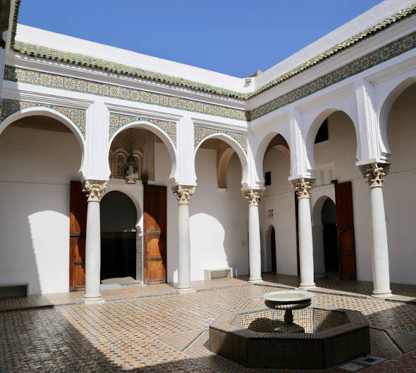
After its liberation, the medina of Tangier resumed its military, diplomatic and commercial role as a gateway to the Mediterranean in the 17th century during the reign of Sultan Sidi Mohamed Ben Abdellah. Subsequently, and particularly during the first half of the 20th century under the international regime, the city experienced considerable urban development that gave rise to several constructions of European style (churches, synagogues, consulates and residences of diplomatic personalities or foreign citizens), symbols of an exemplary cohabitation of different nationalities and religions and of a remarkable blending of cultures.
On 10 April 1947, Sultan Mohammed V delivered at the 9 April square the first speech that referred to a unified and independent Morocco attached to the Arab nation. In 1956, with the independence of Morocco, the Fedala conference (8 to 29 October) returned Tangier to Morocco.
General characteristics
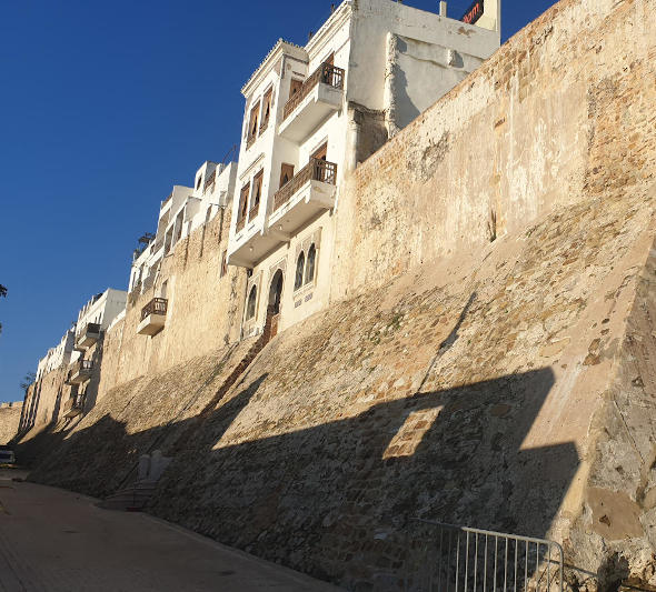
The medina extends over 26 hectares and is surrounded by ramparts of 2200 m. A large part of the current ramparts dates from the Portuguese era (1471-1661).
However, several sections were rebuilt or restored in the English era (1661-1684) and the Alaouite era, which saw the construction of some fortifications in the 18th and 19th centuries. Its urban fabric is homogeneous, of compact and densified morphology, characterised by strong ground occupation (2508 buildings spread over 26 hectares, i.e. 96 buildings/hectare) and a narrow, hierarchised street network, essentially pedestrian and with irregular ramification. The habitable surface does not exceed 30 m² for 47% of the houses, 50 m² for 72% of the houses, and 80 m² for 88% of the houses.
The proportion of tenants is 60% and that of owners does not exceed 40%. Private property exceeds 80% and the rest is distributed between Habous property and state domain.
The safeguarding perimeter of the medina of Tangier
Aware of the multiple transformations undergone by the medina of Tangier and the various aspects of degradation to which it is subject, the Urban Agency of Tangier monitored the elaboration of the development and safeguarding plan of this historical space, launched by the supervising ministry, with the aim of developing an intervention strategy integrating three essential components: human, spatial and heritage.
However, this study, not having reached completion in its approval phase, was integrated into the development plan of the city of Tangier currently being prepared. The safeguarding perimeter of the medina, delimited on the development plan, concerns the entire intra-muros territory and its periphery.
Its purpose is the definition of the basic elements of the safeguarding structure of the medina and its territory, the classification of the land and the establishment of its legal regime, and the implementation of a specific regulation for its development and management.
In order to preserve the identity and the urbanistic characteristics of the historical fabric of the medina, the following provisions have been taken:
- The division of the perimeter of the medina into several urban zones, each characterised by a specific urban or landscape aspect and by the nature of the authorised developments.
- The establishment of provisions applicable to the urban space (reorganising and relocating commercial activity, paying attention to archaeological vestiges during construction works, rehabilitating sanitation and drinking water networks, burying the electrical network, providing a sufficient number of fire hydrants, installing lighting adapted to the medina's environment, prohibiting any occupation of the public domain, respecting the protection easement of the ramparts, respecting the medina's environment in the placement of advertising signs, etc.).
- The establishment of provisions applicable to constructions (drawing inspiration from the original character of the medina for windows and doors, preserving the original patios, ensuring cleanliness and respecting the panoramic views of the terraces, respecting the traditional forms of the sabats and corbels, prohibiting the parcelling of plots and the subdivision of houses, etc.).
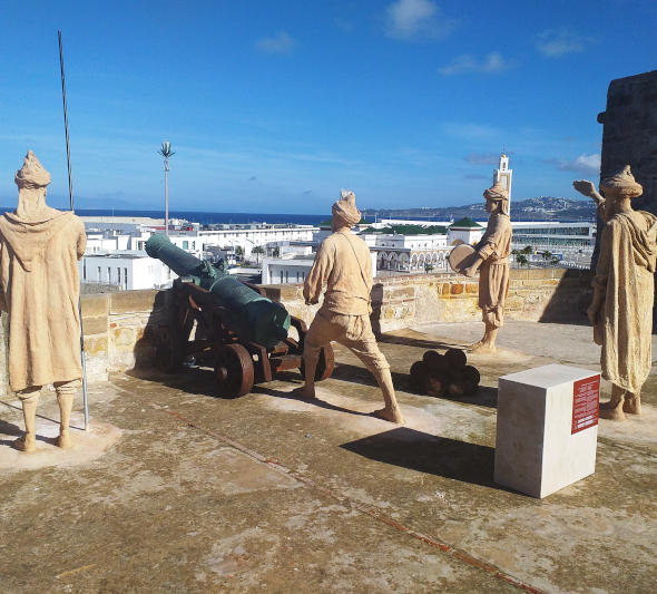
The rehabilitation and valorisation programme of the medina of Tangier (2020-2024):
In application of the royal directives concerning the safeguarding of the cultural legacy of Moroccan medinas and with the aim of preserving the architectural heritage of the medina of Tangier, valorising its heritage potential, perpetuating its authentic character, participating in the reorganisation and development of its economic activities and promoting its tourism activities, a rehabilitation and valorisation programme of this historical fabric was elaborated by the wilaya of the Tangier-Tetouan-Al Hoceima Region, the Urban Agency of Tangier and the representations of the various ministerial departments.
This programme, currently being implemented, is divided into 5 main axes:
- The built environment:this consists of consolidating and restoring buildings threatening to collapse within the medina, redeveloping the urban fabric inside the walls through actions to resurface the streets, repair and reinforce the drinking water, electricity and sanitation networks, install street furniture, restore the traditional fountains and set up signage to guide and facilitate tourist visits. This component also includes the architectural ordering of the façades of a few main thoroughfares, the development of car parks in the immediate surroundings of the medina and the creation of some local amenities (sanitary facilities, a police station, a youth centre, nurseries, a youth hostel, a library and a tourist guidance and outreach office).
- Historic monuments:this component consists of restoring a few historic monuments of the medina to make them accessible to tourist visits, such as the Borj Naam battery, the Borj Ben Amar battery and the southern rampart of the Kasbah with its two gates Bab Haha and Bab L'Assa, as well as restoring and rehabilitating other monuments into cultural facilities, such as "Borj Dar El Baroud", "Borj Naam", the former premises of the hygiene service next to Borj El Hajoui, "Dar Niaba", "Fendak Siaghine", "Cinema Al Cazar" and "the house of Ali Rbati", in addition to the redevelopment and rehabilitation of Fendak Chejra and the redevelopment of Dar Dbagh square.
- Places of worship:the programme provides for the restoration of the "Jdida" mosque, the restoration and repair of 3 mausoleums including the mausoleum of Ibn Battuta, and 6 zawiyas including the "Kadiria" zawiya and the "Issaouia" zawiya.
- Economic activities:this component involves rebuilding "the central market" and "the Sidi Bouabid market", and redeveloping the market located opposite the "Fendak Chejra" building and the "Fendak Zraa" market located in the immediate surroundings of the medina, in addition to installing wooden awnings respecting the traditional character for the commercial shops within the walls.
- Tourist circuits:to make tourists and visitors aware of the history of the medina, its architectural particularities, its international character and its diverse cultural resources, the programme aims to create 5 tourist circuits, namely "the Ibn Battuta circuit", the "Tangier Plurality" circuit, the "Socco Tangier" circuit, the "Universal Tangier" circuit and "the Transversal circuit". In addition, supporting actions will be put in place to promote the tourist product, such as the production of tourist maps, the installation of signage panels and tourist information points, as well as the development of mobile applications dedicated to tourism promotion.
Medina of Assilah
The Medina of Assilah
The city of Assilah is located on the Atlantic coast, about 40 km southwest of the city of Tangier. Together with Tangier and Ceuta, it forms a "bridge" between the African and European continents.
It enjoys a rich architectural heritage and constitutes a remarkable model of preserved and rehabilitated traditional urban fabric. Its strong heritage potential, characterized by imposing fortifications classified on the national heritage list, its buildings of historical and architectural interest and its first-rate cultural facilities, play an important role in promoting its tourist and cultural activity at both the national and international levels, particularly during the summer period.
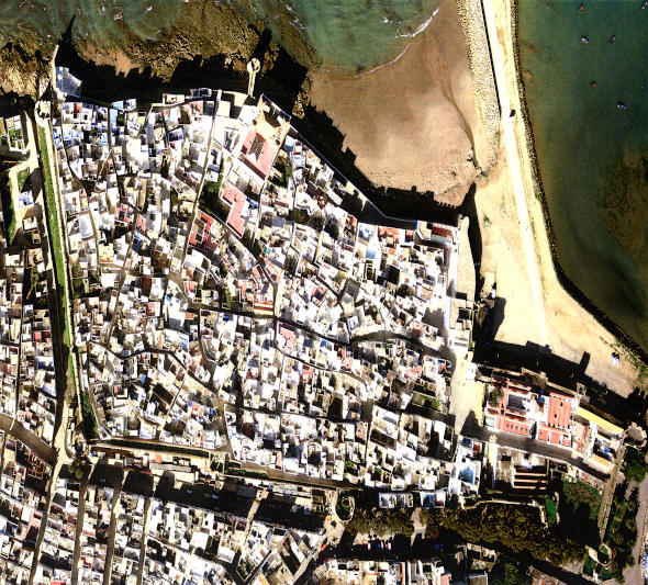
During the last three decades, the medina of Assilah has benefited from a series of cultural initiatives and a pronounced movement of restoration and rehabilitation that have made it possible to safeguard its historical and architectural heritage and to generate certain positive impacts on the image of the entire city and on the development and promotion of its tourist activity.
Historical Overview
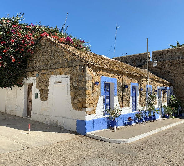
Not far from Zilil, an ancient city located at Dchar Jdid 13 kilometers to the northwest, Assilah owes its origin, according to al-Bakri, the famous Arab geographer of the eleventh century, to a ribat where a garrison came to settle, later replaced by markets to which Andalusian immigrants came, pitching their own tents.
Moreover, the coins discovered prove that Assilah already existed since the beginning of the ninth century. The Idrissids had built a wall there during the first half of the ninth century. In 933-934, the inhabitants of the city, wishing to rid themselves of the Idrissids, requested the help of Caliph Abd Al-Rahman III al-Nasir and ended up handing the city over into his hands.
In the 12th century, Asilah was in full decline, but from the 14th century onwards, the town and its port enjoyed a very active trade: the Majorcans, the Catalans and the Genoese conducted commerce there. In 1307, five Barcelona companies sent commercial representatives to Asilah. The Genoese owned funduqs there. They traded in wheat and wool. The commercial activity of the Genoese remained flourishing after the town was occupied by the Portuguese. After their withdrawal before the Marinid sultan Abd al-Hak, the Wattasid Mohamed al-Cheihk settled there and founded, between 1465 and 1471, the Wattasid emirate of Habt, until the Portuguese occupation.
On 24 August 1471, under the reign of King Alphonse V, the Portuguese took Asilah. They built a stronghold there, with a keep and a vast enclosure. In August 1550, King John III had it evacuated, and in 1577, it was reoccupied by King Sebastian in order to prepare the expedition of Oued al-Makhazin, in 1578. In 1592, the king of Spain and Portugal, Philip II, restored the town to the Saadian sultan al-Mansur al-Dahbi.
In the 17th century, Ghaylan, leader of the resistance in the north-west, settled in Asilah from 1652. From that moment, he organised his resistance movement against the Portuguese, then against the English of Tangier and finally the Spanish at Larache. Moulay Ismail, after recovering the town from the hands of the Spanish in 1691, ordered his governor Ahmad Ben Haddou to build there a mosque, a medersa and a hammam and to repopulate it with Rifians.
In 1829, Asilah was attacked by the Austrian fleet and again by the Spanish in 1860 during the war of Tetouan.
From 1906, the name of Asilah returned to the forefront of the scene: Ahmed Raysouni was its master with the support of Moulay Abd al-Hafid and was appointed pasha as well as governor of Fahs and Anjra and he would erect his palace there.
Description of the Urban Fabric
Extending over an area of 7 hectares, the medina of Assilah is characterized by its remarkable centrality, its homogeneous aspect and its originality compared to other medinas. Its main urban components are: the fortifications of Islamic and Portuguese origin (walls, bastions and gates), the neighborhoods, the squares, the roads and the buildings of domestic and religious character of historical and architectural interest.
The medina of Assilah comprises 5 neighborhoods (hawmat): al Kissaria neighborhood, Ben Ayyad neighborhood, Mgima' neighborhood and Krikia neighborhood. Its main arteries are those connecting Bab al Homar to Bab al Bhar and to Bab al Kasba and Bab al Bhar to Borj Krikia.
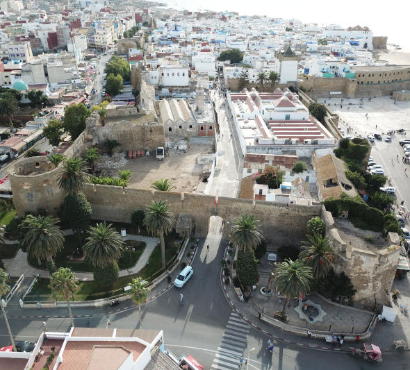
The other streets are organised according to the north-east and south-west orientation, crossing the medina along its length and its breadth and serving the residential quarters and the commercial streets.
Its Kasbah, a rectangular citadel dating from the Portuguese era, was once a stronghold surrounded by ramparts that housed the residences of the governor and the head of the Portuguese army. Currently, it is an open, sparsely built space containing a few dwellings, a sizeable cultural facility (the Hassan II centre for international encounters) and the Great Mosque. During the last two decades, the medina of Assila has benefited from a series of initiatives of a cultural nature and from a marked movement of rehabilitation and renovation which have made it possible to safeguard its historical and architectural heritage and to generate certain positive repercussions on the image of the town as a whole and on the development of its tourist activity.
The Enclosure Wall
The construction of the first ramparts of the medina is said to have been ordered by Mousa Ibn Abi Al Afia around 942-943 A.D. The present ramparts are the work of the Portuguese who decided around 1505, under the care of the architect Diogo Boytac (1460-1528), to reinforce the town's defences and transform it into a solid and massive place of war after several attacks delivered by the forces of the Wattasids.
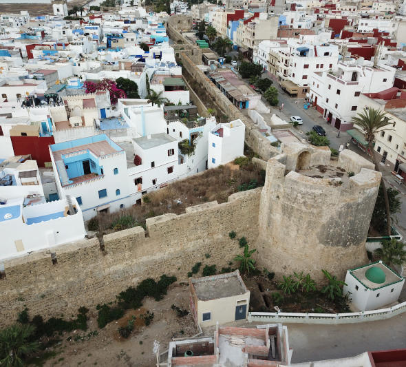
The enclosure of the medina, classified as a historic monument on 24 January 1996, has the shape of an irregular parallelogram, three sides of which face the hinterland and one curved side following the shape of the shore, and its layout has hardly changed since the end of the 15th century. It extends over a length of 1200 m and its height varies between 5 and 7 m. It is pierced by 5 gates and provided with 9 towers and bastions.
The ramparts, on the land side, were surrounded by a dry moat about 8 m in average depth, supported by stone walls (currently Avenue Hassan II and Rue Ibn Battouta) which carried the aqueduct at the bottom and certainly a drawbridge in front of the town gate.
In the 1980s, it was the object of a major restoration operation on the part of the town's municipality under the aegis and technical supervision of the competent services of the Ministry of Culture.
The Bastions and Towers
The bastions and towers of the medina of Assilah currently constitute only landmarks and reference points for the inhabitants after having been structures of defense and control. They have different shapes and dimensions and pierce all sides of the enclosure wall.
A plan of the medina from 1939 reveals 9 bastions and 3 towers, most of which still exist today except for Baluarte de Pite Joao (Petit Jean Bastion), which was occupied by dwellings and was located between the City Bastion (Borj al-Homar) and the Santa Cruz Bastion (Borj Na'am or Borj El Kasba) just behind the current Grand Mosque. The other bastions are: Beach Bastion (Borj El Kaid el Momtaz), Antonio da Foncesca Bastion (Borj Souk Ahfir), Tambalalam Bastion (Borj Lalla Rahma), Cuirass Bastion (Borj Krikia), Saint Francis Bastion (Borj Sidi Mimoun), Spider's Leg Bastion (Borj school Sidi Ali Ben Merzouk).
The El Kamra Tower
The most important of the towers of the medina of Assila is the El Kamra tower, situated to the north of the enclosure and beside Bab Bhar. By its height, which rises to 17 m, this keep, called by the Portuguese Torre de Managem, dominates the medina, the hinterland and the coast.
It is the only element that remains of the governor's castle. Its architectural features refer to the style of the architect Boytac, which would date its construction to 1509. Instead of a military function, the El Kamra tower fulfilled a public and ceremonial function: its large window-balcony, turned towards the public square, served for the official appearances of the governor, and its internal distribution, which denoted a symbolic hierarchy, revealed a prison at ground level, an audience hall where the governor received and gave orders in the name of the King and probably a guardroom on the first floor. Its good current state of conservation and its function as an exhibition gallery is due to a restoration and enhancement operation carried out in 1994 by the Portuguese Foundation Calouste Gulbenkian.
The Gates
The enclosure wall is pierced by 5 gates that ensure communication between the rest of the city and the interior of the medina. Before the Spanish colonization that occurred in 1912, it was provided with only two gates: Bab el Bhar (gate of the sea), located in the northern rampart at the foot of the al Kamra tower and known in Portuguese times as Porta Riviera, and Bab el Homar or the Portuguese Porta da Vila, pierced in the eastern rampart of the enclosure. Bab al Kasba was opened in 1920 in the northern part of the enclosure by the Spanish administration to allow mechanical access to the interior of the medina and create direct connection with the Spanish quarter. The two other gates, much more recent, are Bab es-Souk, opened in the eastern rampart north of Bab el Homar, and Bab Krikia pierced in the southern rampart.
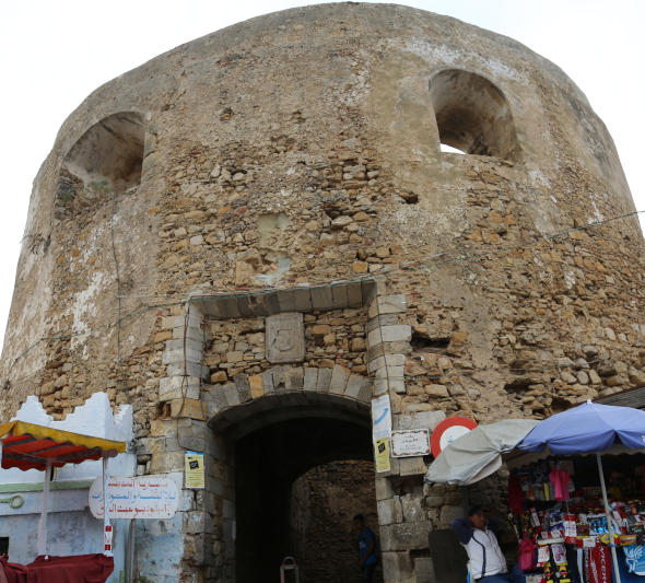
El-Homar Gate-Bastion
The old "Porta e Baluarte da Vila" from the Portuguese era is a gate-bastion that pierces the southern rampart of the medina and constitutes one of the oldest and most famous fortified buildings of Assilah. It forms a projection relative to the level of the curtain wall and an entrance bay in the middle of a truncated-cylindrical tower. The entrance comprises two segmental arches built in cut stone and its surface is decorated by a rectangular Portuguese medallion representing King Alfonso V. The interior corridor with a bend, today open to the sky, once possessed a floor of planking or vaulting forming a covered shelter, a casemate, where two large cannons stood that ensured the defense of the southern part of the city.
The Hassan II Center for International Encounters
This edifice, situated in the Kasbah, opposite the Great Mosque, was built in 1986 on the rubble of a dilapidated building that once served as a barracks for the Spanish occupation army. In the Portuguese era, its location housed the governor's castle, of which today only the imposing keep (Borj al Kamra) remains, standing at the north-west corner of the Kasbah.
The Hassan II centre, whose architecture is well integrated into the old fabric of the medina, is a building composed of a central body covered with a pyramidal roof, surrounded by galleries intended for artistic exhibitions and a multipurpose hall, equipped with a simultaneous translation pavilion, reserved for cultural encounters and activities.
The Raissouni Palace
It is a luxurious dwelling of traditional style situated in the western part of the medina. It was built, as its name indicates, by the Sharif Raissouni in 1906 when he was appointed pasha of the town of Assila. It is composed of a residential part on two levels with outbuildings and a garden.
In 1998, the Raissouni palace underwent a restoration and rehabilitation operation whose financing was provided by the Saudi prince Bandar Ibn Soltan. This project made it possible to safeguard the traditional spatial configuration of the palace and to enhance its original architectural particularities.
Currently it houses a cultural complex composed of artists' accommodation, plastic art and sculpture workshops, a space for cultural and artistic activities and a guesthouse, on the first floor, reserved for the town's guests of honour. The building also serves as the seat of the al Moutamid Ibn Abbad summer university, which organises its cultural encounters and debates there on the occasion of the annual festival of Assila.
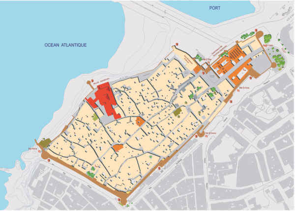
The Safeguarding Plan of the Medina of Assilah
The Development and Safeguarding Plan of the Medina of Assilah, approved on September 15, 2009, has as its main objective to propose to institutional actors and the services concerned a technical tool comprising a structured plan of actions aimed at developing the medina as a cultural and economic hub. It is formalized in three types of documents:
- A graphic document at a scale of 1/1000 that proposes interventions aimed at conserving the main historical and architectural testimonies of the medina, safeguarding the traditional road network, restructuring the road network at the level of the area surrounding the medina, restoring and renovating housing and organizing commercial activity.
- A safeguarding and development regulation that establishes the regulatory conditions to manage the construction movement intra-muros and the development of the area surrounding the medina according to standards respecting traditional architectural values and characteristics.
- A Book of Architectural Prescriptions (CPA) containing a normative reference of the characteristic architectural elements of the medina of Assilah in order to ensure the safeguarding of the architectural identity of this traditional fabric and to guarantee the permanence of its historical reading.
The Rehabilitation and Valorization Program of the Medina of Assilah
In application of the royal directives concerning the safeguarding of the cultural heritage of Moroccan medinas and with the aim of preserving the architectural heritage of the medina of Assilah, valorizing its heritage potential, reorganizing its economic activities and promoting its tourist attractiveness, the wilaya of the Tangier-Tetouan-Al Hoceima Region and the Urban Agency of Tangier, in collaboration with the various departments concerned, developed a program of rehabilitation and valorization of this historical fabric consisting of 4 main axes:
- The built environment: this aspect concerns the consolidation and repair of a set of buildings threatening ruin in the medina and the rearrangement of the intra-muros urban fabric through the operations of paving the streets, repairing public lighting, reinforcing the drinking water, electricity and sanitation networks, installing urban furniture, and installing appropriate signage. It is also a question of carrying out the architectural ordering of the façades of a few main axes, the development of two car parks in the immediate surroundings of the medina and the creation of some local amenities (a square, public toilets, a women's centre and a youth centre).
- The historical monuments: this involves restoring the second part of the southern rampart on the side of the Sqala, carrying out repair works at the Ibn khaldoun school, and restoring and rehabilitating other historical monuments of the medina (the Kamra tower, the "Tama Ghaylana" school overlooking Abdellah Guennoun square and "Dar El Bacha" overlooking Ibn khaldoun square).
- The places of worship: the programme provides for the restoration of the "Sidi Mbarek" mosque-zaouia, the "Derkaouia" mosque-zaouia, the carrying out of repair works at the "Zekkouri" mosque and the restoration of the mausoleums "Sidi Ahmed Tayeb Bakkali Al Assili", "Sidi Ahmed Ben Merzouk", "Sidi Ahmed Ben Mansour" and "Lalla Mennana" in addition to the reconstruction of a synagogue.
- The economic activities: to give a heritage-like and authentic appearance to the commercial premises of the medina, the programme provides for the installation of awnings and wooden signage panels respecting the traditional character in force. It also provides, with the aim of promoting the local tourist product, for the implementation of accompanying actions such as the drawing up of tourist maps, the setting up of tourist information points and a video surveillance system, in addition to the production of mobile applications dedicated to tourism promotion.
- The tourist circuits: to revitalise the tourist activity of the medina and guarantee a good presentation of its heritage potential, the programme aims at the creation of 3 tourist circuits which are "the rampart circuit", which allows one to discover the defensive system of the medina with its gates, its towers, its batteries and its rampart walk, "the religious circuit" which runs through the various existing religious buildings such as the mosques, the zaouias and the mausoleums and "the commercial circuit" which facilitates the discovery of the bazaars, the traditional craft workshops and the premises selling handicraft products.
Architectural Heritage
The Contemporary Architectural Heritage of Tangier
The history of the city of Tangier, as a land of welcome, was marked by the successive presence of several civilizational and cultural currents, brought by the flows of populations of diverse nationalities (Portuguese, Spanish, Italian, French, English and American).
Architectural production, as a reflection of the various successive eras, expresses the diversity and richness of the styles of thought and of the use of space prevailing at each of these stages in the history of the city of Tangier, as still attested by certain buildings located in the extra-muros sectors of the city.
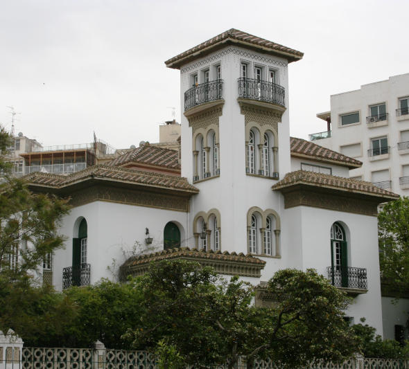
However, under the effect of increased urbanisation and the sustained densification of the sectors in question, it must be noted that a significant part of these buildings is currently threatened by speculative temptations, seeking rent in the value of the land on which the building stands rather than in its heritage and historical value.
Moreover, it is well known that in Tangier only a few monuments are legally protected, through inscription or classification. So many factors thus make topical the generalisation of conservation measures to other monumental components, notably the buildings of heritage and architectural interest in the extra-muros zone, witnesses to the architecture of the second half of the 19th and the beginning of the 20th century.
History of the Contemporary Heritage Intra-Muros
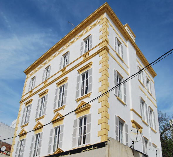
The urban history of Tangier since the nineteenth century is closely linked to its status as a diplomatic capital.
Indeed, the consular representatives of foreign countries, established within the intra-muros perimeter of the medina, and the merchant and bourgeois social class, attracted by the commercial vitality of the city, erected constructions characterized by a European architectural and decorative typology. Thus, from 1880, the medina of Tangier underwent a series of architectonic interventions of varied styles that would certainly transform the general appearance of certain streets and modify part of its traditional character, but which would also mark forever its cosmopolitanism that constitutes its richness and its particularity (these transformations motivated the creation in 1883-1884 by Dr. Cenarro of the commission of hygiene and roads, which was the first international body in charge of urban planning matters in Tangier).
The eloquent example of this Europeanisation is the Petit Socco (Souk Dakhel), which, with its banks and its cafés, constituted a veritable business and commercial centre of international standing.
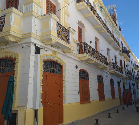
It is to the south of the medina, in the Beni Idder and Oued Aherdane districts, that the European-style constructions are concentrated. This style is characterised by large buildings of two or three storeys, with façades composed of balconies with French windows and railings of wrought iron and openwork wood (Spanish style) and façades fitted with capitals, at the corners of the walls, with cornices and an attic storey (French style). Examples of façades of mixed style, Arab-Islamic and European or "Hispano-Moorish", are also present, notably along Siaghine street.
History of the Contemporary Heritage Extra-Muros
At the end of the nineteenth century, the appearance of the extra-muros city was fully felt in the face of the lack of intra-muros space and the growing necessities of commerce and housing.
The first extension extra-muros takes place along the walls through neighborhoods or architectural ensembles of European style that form an urban belt all around the medina (buildings of the rue d'Italie, the rue de Tétouan, the rue Sallah Din al Ayoubi, etc.) or through remarkable individual edifices (Hôtel Continental, Hôtel Villa de France built respectively in 1860 and 1861). At the same time, the Marchan plateau and the promontory of Jbel Kbir, to the west of the city, experience a parallel urbanization in the form of residences, luxurious properties and institutions of importance (Villa Mokri, Tazi Palace, Forbes Palace, etc.).
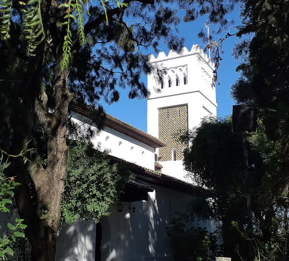
Urban development to the south and south-east of the medina takes place, in the first instance, through the construction of a number of landmark edifices and public works (the Moroccan Debt House, where the Regional Tourism Delegation is currently housed, built in 1910, the great Cervantes theatre in 1913, the Café de Paris in 1920, the El Menzah Hotel in 1928…).
This development accelerates, in a second phase, to result in the general framework of the new town and in its structure characterised by a main artery of 230 m called Boulevard Pasteur and a coastal fringe running along Avenue d'Espagne where the Renshhausen buildings are located (Avenue d'Espagne).
The Protection Measures
However, this heritage is threatened, today, with disappearance because of the accelerated rhythm of urbanization and the impact of the phenomenon of real estate speculation and its worrying state of degradation, which is due to several intrinsic and extrinsic factors (wear and aging, lack of maintenance, poor occupation, non-integrated construction and repair works, etc.). The losses are already considerable if one counts the number of buildings that have disappeared or been disfigured in recent decades, and the negative trends are still present in the city.
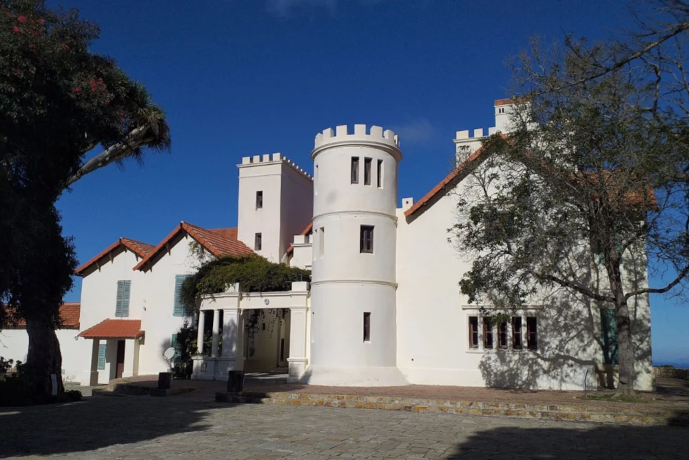
To remedy this process of disappearance and deterioration, a series of priority measures of regulatory protection were carried out by the Urban Agency of Tangier:
- Establish an initial inventory of extra-muros buildings of historical, architectural or aesthetic value, pursuant to the provisions of the regulations of the former development plan of the urban municipality of Tangier (2003-2013) concerning the specific regulation zone. The selection criteria that governed the establishment of this inventory are:
The age of the building and its state of conservation. The aesthetic value of the building. The style and the reference architectural character of the building. The history linked to the building. The views, perspectives and arrangements that marked and shaped the imagination and perception of the city, both for the Tangerine and for the visitor. - To institute a protection zone for buildings of historical and architectural interest at the level of the urban planning document. A first operational conservatory measure was taken by the Urban Agency at the level of the old development plan of the urban commune of Tangier (2003-2013), consisting of delimiting the perimeter containing the remarkable buildings of historical and architectural interest by a protection zone subject to specific regulations. The new development plan of the city under preparation created protection easements linked to the historical sector (HS) housing buildings of historical and architectural interest. In this sector, buildings of historical and architectural interest must be preserved and the commission for granting construction authorizations that examines the projects of restoration, repair or renovation of these buildings must ensure the safeguarding of their patrimonial architectural qualities and their specific exterior aspects. Other individual buildings of historical interest existing outside the limits of this sector are subject to the provisions of this easement.
Classification & Inscription
Classification and inscription
The legal protection of the archaeological and architectural heritage of Tangier
In order to provide a strong, lasting legal basis of national scope capable of guaranteeing the protection of the archaeological and architectural heritage of the city of Tangier, in replacement of the ten-year conservatory measure of the development plan, a procedure for classification or registration as a national historic monument was initiated by a local technical committee comprising the Wilaya of Tangier, the Urban Agency of Tangier and the Inspectorate of Historic Monuments.
The legal texts of reference for this procedure derive from Law 22.80, which concerns the procedures for classifying or registering cultural property ranging from historic monuments and sites, to registrations, to works of art and antiquity presenting « for Morocco, a historical, archaeological, anthropological interest or of interest to the sciences of the past and the human sciences in general…».
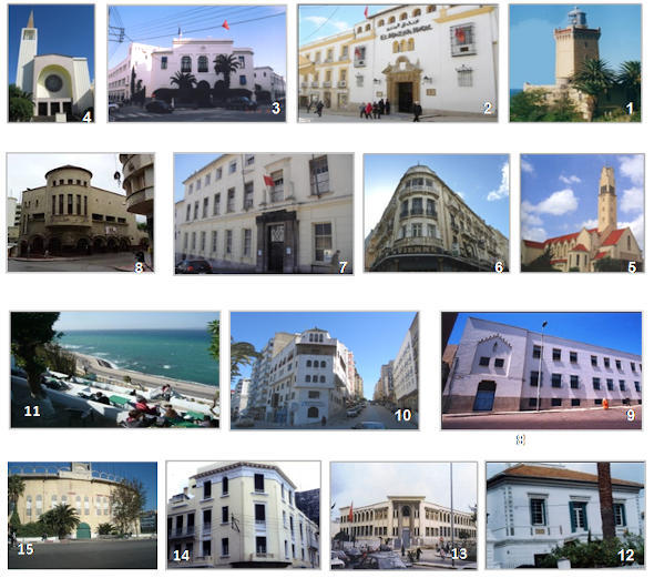
The operation of classification or inscription in Tangier of sites and buildings of historical and/or architectural interest began at the start of the twentieth century during the period of the international regime and was interrupted for 53 years, only to resume in 2004. Thus, the process of legal protection of heritage sites and buildings in Tangier can be divided into 2 distinct periods:
The period of the international regime
During the period of the international regime, the city of Tangier saw between 1934 and 1950 the classification of the following sites and monuments:
| Classification of the Punic-Roman necropolis of Marshan(law of 24 March 1934 – Official Bulletin No. 102 of 15 April 1934 - p. 174). |
| Classification of certain edifices of the city (medina) of Tangier(law of 30 August 1940 – Official Bulletin No. 265 of 15 September 1940 – p. 522): the walls and fortifications of the city of Tangier, the Grand Mosque, the Issawas Mosque, the Marine Gate, the fountain of Siaghine Street, the gate of Dar Niaba, the palace known as « York Castle », the tower of Sania Street, the tower of Amsrouk Street, the gate of Dar Baroud |
| Classification of the perspective of Boulevard Pasteur and the perspective of the Rock of Sidi Amar(Official Bulletin No. 330 of 3 August 1947 p. 435). |
| Classification of the Kasbah square of Tangier and its surroundings(law of 9 December 1947 – Official Bulletin No. 338 of 15 December 1947. p. 543). |
| Classification of the site of the Caves of Hercules(law of 30 December 1950 – Official Bulletin No. 415 of 15 January 1951. p. 32). |
The period of independence
During the period of independence between 2004 and 2024, the city of Tangier saw the classification and inscription of a remarkable number of buildings and sites:
| Classification of the Hôtel Villa de France in Tangier(decree of 12 October 2004. Official Bulletin No. 5260 of 28 October 2004). |
| Classification of 7 Buildings on Avenue d’Espagne in Tangier(decree of 18 May 2006. Official Bulletin No. 5428 of 8 June 2006): Hôtel Continental, Kursaal Français building, Renchaussen building, Estado Espagnol 14 building, Hôtel Valencia, Hôtel Excelsior and Hôtel Cecil. |
| Registration of the Dox Monopolio building in Tangier(order of 13 September 2007. Official Bulletin No. 5571 of 22 October 2007). |
| Registration of 19 buildings in the city of Tangier(order of 13 September 2007. Official Bulletin No. 5571 of 22 October 2007) |
| : Cervantes Theatre, Villa Msalla, Villa Miramonte known as Mazal, Villa Mabrouka, Villa Bahia, former headquarters of the newspaper « Diario Espagnol », Villa Rosas, Victoria 4 building, Maison des Arbres building, Wakrim Frères building, Villa Rosa, former Consulate of Great Britain, Villa Harris, Moulay Hfid Palace, Dar Salaf building, Villa Welcome, Villa Al Amana, « les sables d’olonnes » building, buildings of Rue de Tétouan. |
| Registration of the headquarters of the Moulay el Mehdi Institute in Tangier(order of 27 April 2009. Official Bulletin No. 5748 of 2 July 2009). |
| Registration of 18 buildings in the city of Tangier(order of 09 March 2016. Official Bulletin No. 6453 of 04 April 2016): Dar Niaba and the American Legation in the medina, the Mendoubia building at the 9 April square, Amram building, Vienna building, Oum Ayman School, building of Rue d’Amérique Latine, March 2 bis building, Berchet College, Café Hafa, Villa No. 42, Cap Spartel Lighthouse, Hôtel Menzah, Lycée Regnault building, Spanish cathedral, Maurétania Cinema, French Church of Saint Joan of Arc and the bullring (placa de toros). |
| Registration of 27 buildings located in the Boulevard Pasteur sector in Tangier(orders of 06 June 2016. Official Bulletin No. 6922 of 29 September 2016): Toledano 10 building, Toledano 11 building, Emilia II building, Conchita building, Bendrihem building, Cabrera building, Mesody building, Flores building, Casita building, Belle vue building, Propriedad Gimenez III building, Marengo building, Rebecca building, Delacroix building, Hôtel Velazquez Palace building, Vilasa I building, Vilasa II building, Mary building, Ben Ayyad building, Nardo building, Ellis III building, Villa SMD building, Parres Puig building, Aerobella building, Mag building, Mercedes building, Valergues building. |
| Registration of 21 buildings located in the Boulevard Pasteur sector in Tangier(orders of 14 July 2017. Official Bulletin No. 6598 of 24 August 2017): Goya building, Mary Angèle building, Simy building, Mayon building, Emilia VII building, Ellis 3 building, Zaharat building, Massiia building, Layla building, Guadalope 1 building, Azucena building, Tétouan III building, Bensheton I building, Nelly 1 building, Lucette building, Mozi building, Azucena lot B building, Almagro building, Garen building, Commercial building and Rambrandt building. |
| Registration of 9 buildings facing Salah Din Al Ayyoubi Street in Tangier(orders of 14 July 2017. Official Bulletin No. 6598 of 24 August 2017): Restintica 9 building (No. 98), Restintica 9 building, Penia 3 building (No. 96), Penia 1 building (No. 106), Contasa 2 building (No. 63), Contasa 2 building (No. 65), Villa Mimi Calpe building (No. 71), Rayda building (Pension Miami), Pension Madrid building. |
| Registration of the Tangier golf course(order of 27 November 2017. Official Bulletin No. 6635 of 01 January 2018). |
| Registration of the Kasbah of Ghaylan in Tangier(order of 21 December 2017. Official Bulletin No. 6635 of 01 January 2018). |
| Classification of the archaeological site of Zilil in the commune of Had El Gharbia(Decree of 05 September 2018. Official Bulletin No. 6710 of 20 September 2018). |
| Registration of the archaeological site of Aqwass Briech in the commune of Briech(order of 04 May 2023. Official Bulletin No. 7211 of 10 July 2023). |
| Registration of Villa Agoumi and the animal cemetery in Tangier(order of 02 January 2024. Official Bulletin No. 7279 of 04 March 2024). |
| Registration of the Roman camp Al Bonian in the commune of Jouamaa(order of 02 January 2024. Official Bulletin No. 7279 of 04 March 2024). |
| Registration of the kasbah of Sayoufa in the commune of Jouamaa(order of 02 January 2024. Official Bulletin No. 7279 of 04 March 2024). |
| Registration of the archaeological site of the Roman camp of Tabernae in the commune of Sahel Chamali(order of 22 February 2024. Official Bulletin No. 7287 of 01 April 2024). |
| Registration in the National Heritage Inventory Register of the Ksar Talyano building in Tangier(order No. 24.859 of 28 March 2024. Official Bulletin No. 7298 of 09 May 2024). |
| Registration in the National Heritage Inventory Register of the old railway station of Tangier(order No. 24.1130 of 30 April 2024. Official Bulletin No. 7306 of 06 June 2024). |
| Registration in the National Heritage Inventory Register of the Villa Safari in Tangier(order No. 24.1713 of 4 July 2024. Official Bulletin No. 7322 of 01 August 2024). |
| Registration in the National Heritage Inventory Register of a site and two buildings in Asilah(order No. 25.235 of 22 January 2025. Official Bulletin No. 7380 of 20 February 2025). |
Conclusion
The buildings and sites classified or inscribed as historical monuments in Tangier from 1934 to 2024 number 126. However, it is worth noting that the number of 15 buildings and sites classified during the era of the international regime remained unchanged for 54 years until 2004 with the classification of the Hôtel Villa de France. From that year, the rhythm of classification and inscription progressed remarkably thanks to the continuous efforts of the tripartite commission composed of the Wilaya, the Urban Agency of Tangier and the Inspection of Historical Monuments, in addition to the interest displayed by associations for the protection of local cultural heritage, to reach by the end of 2024 the number of 126 buildings and sites classified or inscribed. The process of legal protection of the archaeological and architectural heritage of the city of Tangier still continues and a new list of buildings to be inscribed on the national heritage list is being prepared.
BUILDINGS AND SITES OF INTEREST
Archaeological Sites
The Archaeological Sites of the Territory of Tangier
Archaeological sites are a fragile and non-renewable public resource. They are the material traces of the past that allow a better knowledge of the different periods of the city's history, inform about the political, socio-economic and cultural developments of society and constitute a considerable tourist potential.
The archaeological prospections and excavations carried out in the territory of the city of Tangier and its coastlines since the first half of the last century have allowed the discovery of an impressive number of sites dating from different civilizations (prehistoric, Phoenician, Roman and Islamic).
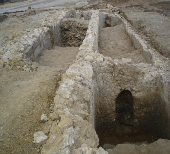
The vestiges visible today, such as the Achakkar caves and the Cotta site at Cap Spartel, the Punic-Roman necropolises of Merchan and the rue Ibn al Abbar, the arsenal of Tangier called "kasba of Ghaylan", the Roman military camp El Bonian on the rue de Tétouan, the kasba of Sayoufa in the douar of Sayoufa next to Hakama, the archaeological site of Ksar Sghir, the Roman ceramic workshop of El Kouass at Briech, the Roman city of Zilil at Had el Gharbia near the city of Assilah, represent only a tiny part of a much richer treasure that marks out the entire territory of Tangier.
The Caves of Hercules
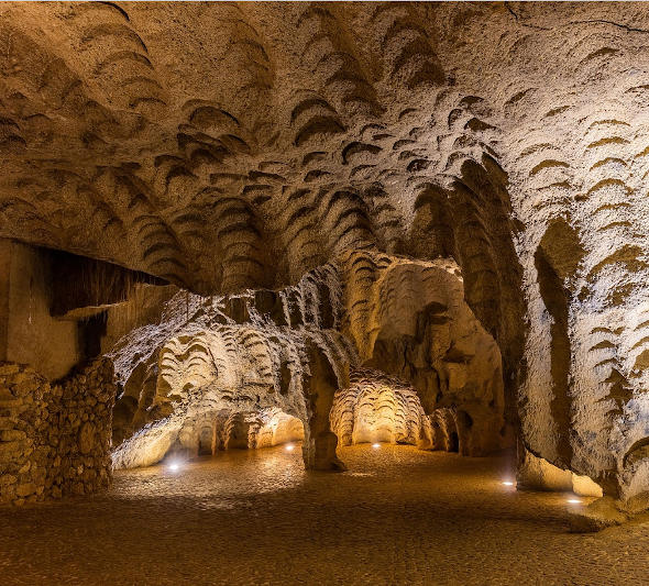
The Grottoes are located on the massif of Cap Spartel, off the Atlantic coast. They constitute incontestably the first tourist destination in Tangier and the most visited site due to its natural beauty, its mythological charge and its considerable heritage value.
This value is attested by important archaeological witnesses, dating in particular from the Neolithic era, brought to light during the excavations that the caves were the subject of since their discovery in 1878. The caves and their immediate environment were classified as a historical and picturesque site since December 30, 1950.
The Caves of El Khil
On the right bank of the Oued Zitoun, 150 m from the estuary, is located a network of cavities, partially filled with sediments, opening towards the south, called the El Khil caves.
The El Khil A, El Khil B and El Khil C caves, constituting this network, were reported as early as the end of the nineteenth century. The excavations undertaken from 1947 by the American mission and in 1958 and 1984 by the French mission yielded archaeological material belonging in particular to the Neolithic era (cardial ceramic and a female figurine in terracotta). The collections are kept at the Peabody Museum of the University of Cambridge in the United States and at the archaeological museum of Tangier.
The Necropolis of Ain Dahlia Lekbira
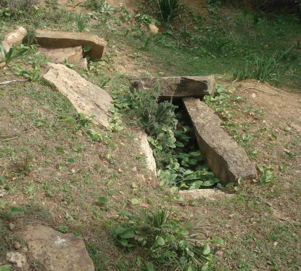
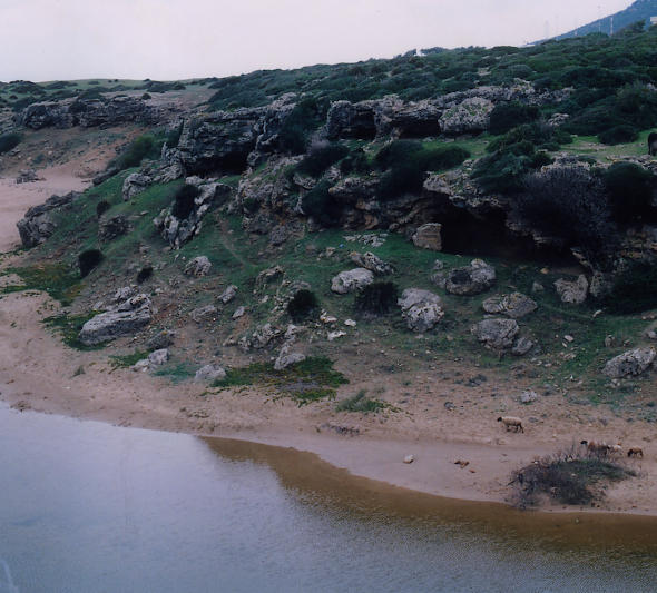
Located about 15 km south of the modern city of Tangier, this archaeological site extends on the flank of a hill at the foot of the mountain "Jebel Dahar Zhirou", in a fertile region where the Mehardad river flows with its tributaries. The excavations revealed traces of a megalithic necropolis of the Phoenician-Punic era, composed of 84 tombs, of which 77 of the "chest" type, generally of rectangular and trapezoidal shape, 2 sarcophagi and 5 tombs constructed by the assembly of well-cut blocks.
The dimensions of the tombs are very different in length and width: from 1 to 2 meters for the largest examples, and from 20 to 30 centimeters for the most modest. The depth varies, however, from 10 to 80 centimeters.
The funerary furniture discovered consists essentially of ceramics and metallic objects ordinary and typical of the era, with the exception of jewelry made of both gold and silver according to artisanal traditions clearly borrowed from the Phoenician civilization. Given the absence of lamps, Punic statues and Greek ceramics of the 5th-4th century BC and the rarity of Attic vases, the typology of the tombs and the manufacture of the discovered metallic pieces lean towards a dating between the 7th and the beginnings of the 5th century BC.
The Site of Cotta
Only a few kilometers from Jorf Al Hamra, at the foot of Ras Achakar near the Caves of Hercules, is located the site of Cotta, considered the largest architectural ensemble cleared in the region of Tangier. Its existence extends from the 2nd century BC to the end of the 3rd century AD.
It is an industrial establishment for fish salting and the manufacture of garum (fish oil) that was part of a large consortium grouping several factories of Andalusia and Northern Morocco. The first excavations were carried out there by C. de Montalban, but it is to M. Ponsich that the merit returns of having cleared these ruins and of having brought precisions regarding their chronology.
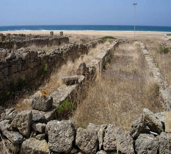
The soundings carried out from 1959 outside the factory yielded material that allows the assertion that the site was occupied as early as the 3rd-2nd century BC. The site of Cotta represents a strategic point for coastal navigation and was the nucleus of a human settlement since prehistoric times. It takes the form of an industrial complex composed essentially of fish-salting workshops and Garum production. It consists of a large number of basins whose depth reaches 2 m. Under the reigns of King Juba II and his son Ptolemy, this activity expanded, thereby allowing the emergence of other parallel industries, notably the extraction of salt and purple dye.
The site of Cotta contains a salting factory of the Roman period that is considered among the best preserved establishments in the western Mediterranean. Currently the site is formed of several constructions, the most important of which are the salting workshop, the thermal baths, gallery edifices and a temple.
The Necropolis of Mershan
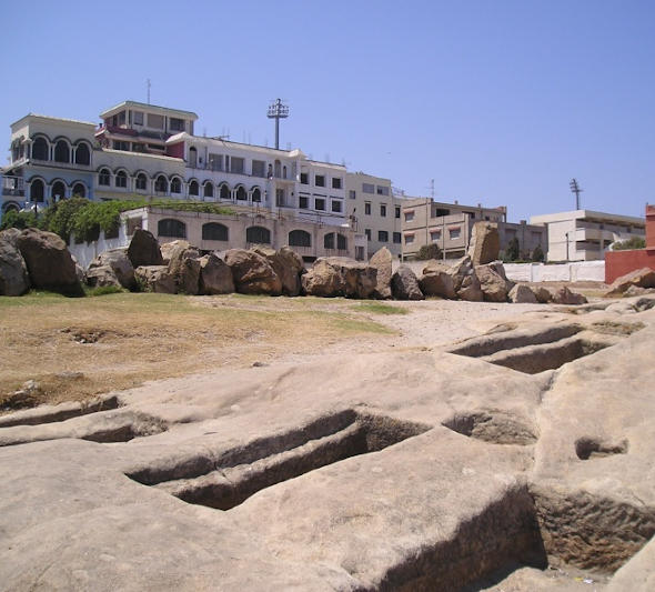
The necropolis of Mershan, called "glissoirs du Marshan", was classified as a historical monument on February 15, 1934. It is located to the northeast of Tangier, 450 m from the ramparts of the medina on the rocky plateau of Mershan, forming a sheer drop of 15 m over the sea. Ninety-eight (98) tombs were exhumed, of which more than fifty (50) cut in caisson form in the rock of the Merchan plateau.
This necropolis provided little datable material, but on the whole we are in the presence of an archaeological site where objects of Punic or neo-Punic tradition were exhumed, with Roman material from several eras.
The Site of El Kouass
The site of Kouass is located on the right bank of the oued Gharifa, about 25 km south of Tangier, and a few kilometers north of Assilah. The geographical and topographical position of Ras Kouass explains, without doubt, the reasons for the choice of this location in antiquity. The presence of the Gharifa river, the proximity of a natural port, the presence of fertile lands and clay quarries permitted and facilitated, certainly, human settlement on the site of Kouass.
The excavations carried out on the site allowed the clearing of several potters' kilns of the pre-Roman era that produced amphorae and ceramics during a long period extending from the 6th to the 1st century BC. In addition to the potters' workshops, M. Ponsich recognized a construction of defensive character that approaches, from the point of view of construction technique, the pre-Roman buildings of Tamuda and Lixus, salting factories dated to the imperial era (1st-2nd century AD), an aqueduct and a cistern.
The City of Zilil
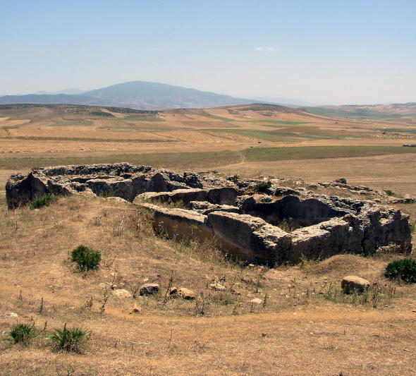
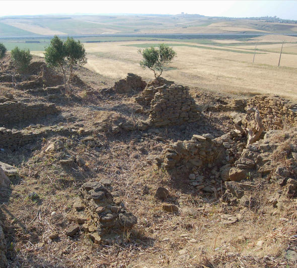
The site of Dchar Jdid is located 13 km to the northeast of the city of Asilah and to the east of the village of Had el Gharbia. It occupies, with the suburban buildings, an area of 32 ha, at the extremity of an east-west oriented projection of a plateau, which, to the west, descends gently towards the coastal plain. In 1977, a Moroccan-French team resumed archaeological research on the site. The excavations undertaken on "the citadel" between 1977 and 1980 confirmed the idea of an occupation of the site in the pre-Roman era (end of the 2nd century BC and third quarter of the 1st century BC).
Between 33 and 25 BC, the city was destroyed and the emperor Augustus established there one of the three Roman colonies of western Mauretania, Iulia Constantia Zilil. The excavations undertaken on the site have made it possible to uncover residential quarters, a large temple, a thermal complex, an imposing cistern with four compartments, fed by a partly underground aqueduct, which would be built to supply it with water, subsequent to Hadrian. Finally, in the second half of the 2nd century, like other cities of Tingitana, Zilil acquired a rampart, partially excavated near the north and west gates, but identified over most of its course thanks to electrical prospecting.
The city was destroyed, at an archaeologically indeterminate moment, between 238 and the middle of the 4th century. The study of the coins from the excavations of Dchar Jdid shows that the reconstruction of the city results from an imperial decision and can be dated fairly precisely to the years 355-360 AD. The most spectacular creation is that of an early Christian church, with three naves, provided with a baptistery and various annexes, near the west gate of the rampart, the only monument of this category uncovered in Mauretania Tingitana. The city was destroyed at the beginning of the 5th century. But the date of the definitive cessation of the occupation of the site has not yet been determined.
The Site of El Benian
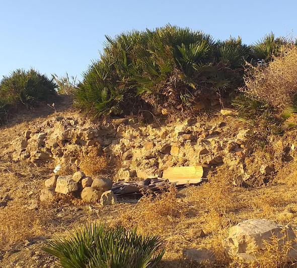
The site of El Benian is located on the Tétouan road, 22 km to the east of the city of Tangier. It is a Roman military camp, whose vestiges were discovered in 1876 by the French archaeologist Charles Tissot, built at the end of the 3rd century AD to reinforce a line of defense composed of the camps of Ghandori, Tamuda and Souiar intended to protect the city of Tingis (Roman Tangier) and its region against the attacks of the indigenous population.
Recent archaeological excavations (2009) reported the discovery of pottery objects dating back to the 1st century AD. This find suggests that the site of El Benian was occupied at the aforementioned date before being transformed into a military camp in the 3rd century AD.
The Thermal Baths of Ayn al Hammam
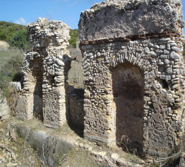
22 km to the southwest of Tangier, at the foot of the Charf Laakab plateau and at the edge of the Tahaddart lagoon, exists the site of Ayn al Hammam near a spring of the same name. These thermal baths, presenting themselves in the form of two distinct building bodies, were excavated in 1910, 1958 and 1960.
Their isolation in the open Tangerine countryside did not fail to excite the curiosity of historians and archaeologists, some of whom see a thermal station frequented by the inhabitants of the region and others an establishment placed in the periphery of an ancient city.
The Archaeological Site of Ksar Seghir
The medieval city of Ksar Seghir, forming part of the "Circle of the Strait of Gibraltar", currently constitutes one of the major archaeological sites of Morocco and one of the most prestigious of the Mediterranean rim.
The medieval occupation of the site was preceded by a human presence attested in its immediate territory as early as antiquity, indeed even from prehistoric times.
The ancient site of Dhar Asekfane (6th century BC – 4th century AD), located about 500 m south of the medieval town of Ksar Seghir, remains to this day the most enlightening witness of ancient occupation in the region of Ksar Seghir.
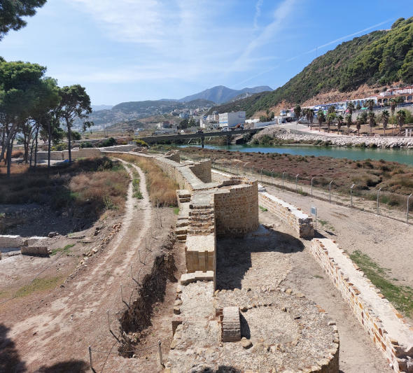
The medieval site of Ksar Seghir covers about 2.5 hectares in area and is composed of two monumental and urban units: the Islamic town and the Portuguese citadel.
The Islamic town is inscribed within a circular enclosure of 200 m in diameter, conferring upon it its planimetric and urban originality both in Morocco and in the Muslim West.
Our information on the site during the Early Middle Ages is very sparse. It was first mentioned in the 10th century by Marsa Bab al Yem (anchorage of the gate of the sea), after having been occupied by a Ribat. Under the Idrissids, it was part of the principality of al-Kacem Ibn Idris II. In 971, the Umayyads of al-Andalus attempted to appropriate it following an expedition ordered by the caliph al-Hakam al-Moustansir. In the 11th century, it is cited under the name of Kasr al-Majaz (castle of the crossing), Madinat al-Yam (the city of the sea) or al Kasr al-Awal (the first castle). In the same century, the site, also known as Kasr Masmouda, was used as a departure base by the Almoravid Emir Youssef Ibn Tachfin during his second crossing towards al-Andalus in 481 of the Hegira.
Under the reign of the Almohad caliphs, notably Abd al-Moumen and Yaakoub al Mansour, Ksar Seghir became a great naval construction yard and was the most used port in the passages towards al-Andalus. The Merinid sultans, Yaakoub Ibn Abd al-Hak, Youssef Ibn Yaakoub and others also made use of it in their crossings towards al-Andalus. In 686H/1287, the Merinid sultan Youssef Ibn Abd al Hak fortified the town of Ksar Seghir by endowing it with a circular enclosure and monumental gates.
From the second half of the 15th century, the town underwent a new fate with the landing in 1458 of the Portuguese forces under the reign of Alphonse V. After their evacuation in 1550, in the time of Jean III, the site served at the beginning of the 17th century as a port to receive the Morisco population expelled from al-Andalus.
With the Lusitanian occupation, the Islamic town underwent multiple transformations that affected public and religious edifices, but it especially experienced the implantation of a defensive system foreign to Islamic architecture: this is the citadel and its famous Couraça.
The Arsenal of Tangier called Kasba of Ghaylan
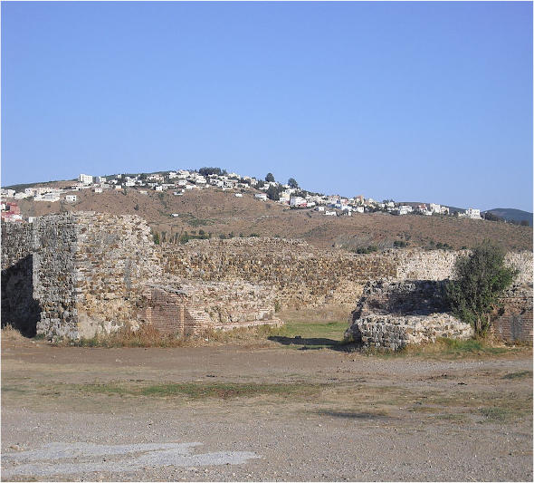
The vestiges of this monument are located on the Malabata road, on the left bank of the oued al Chat about 2.5 km from the old Medina. They are bounded to the north by Boulevard Mohamed VI connecting Tangier-city to Malabata, to the south by the Tanja al-Balya neighborhood, to the east by a lacustrine landscape and to the west by the summer residence of Bank al-Maghrib.
The monument is an architectural achievement that would date back to the 14th century, during the reign of the Marinid dynasty. It would be a naval shipyard, a Dar Sina'at soufoun, that existed in Tangier since at least the 11th century.
The monument presents two ramparts with substantial dimensions evoking a fortress of monumental size. The eastern rampart presents a parapet walk, five towers of square form, most of which are in a state of ruin, and two other towers of more substantial dimensions at the north-eastern and south-eastern extremities. The fortress is accessed by two gates pierced in the northern rampart and defended on either side by oblong towers. For lack of in-depth archaeological research, the exact location of the southern and western ramparts is unknown to this day.
According to the description, the monument seems endowed with the principal elements of defence (towers of rectangular form, monumental gate defended by towers and parapet walk) that confer upon it a military role. However, its topographical placement in a lacustrine and fluvial landscape not far from the sea amply justifies its function as a naval construction yard.
The Kasba of Sayyoufa
The kasba of Sayyoufa is located to the south of the douar of the same name belonging to the commune of Jouamaa dependent on the territory of the Fahs Anjra Province. Perched on a rocky peak of the mountain of "Zinat" at an altitude of nearly 300 m, it is accessible from national road No. 2 leading to Tétouan via a track of 2.5 km distant by about 900 m from the center of "Hakkama".
The strategic position of the site allows control of the valley extending from the south and west sides, of which the "Ibn Batouta" dam, built on the oued "Sania", occupies an important part. This site also dominates the plain extending as far as the oued Tahaddart, the tertiary road connecting Tangier to Dar Chaoui and the main road connecting Tangier to Tétouan.
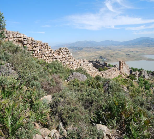
The local population designates the hill that shelters the site by the appellation « loutea » or flat terrain, and the archaeological structures by the appellation « ksiba » or « kasba ».
The fortress in its current state is composed of an enclosure in the form of an irregular pentagon following the topography of the terrain, provided with a parapet walk and a parapet and reinforced with towers of square form, some of which are collapsed and others are merely a heap of stones. The construction materials are roughly hewn rubble stones of varying dimensions bonded with a lime mortar.
Given its impregnable situation, this site was certainly part of the network of Islamic fortresses built on strategic sites all along the itineraries and roads.
The Kasba of Agla
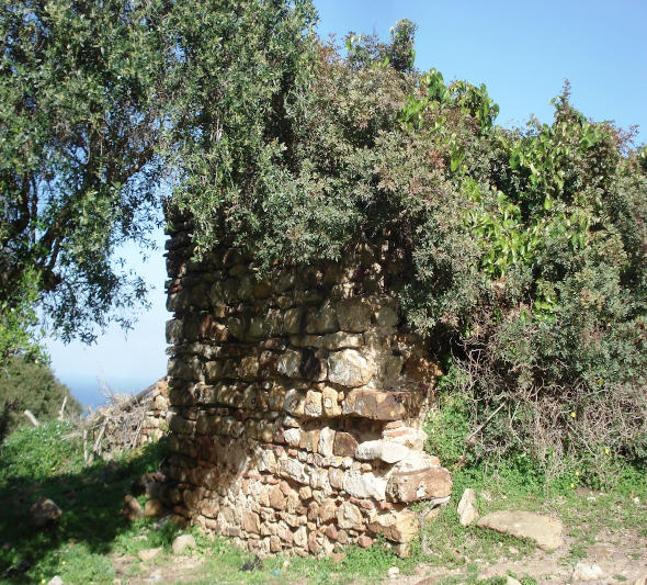
The fortress of Agla is located about 5 km to the west of the city of Tangier and to the southeast of the Perdicaris forest. From the Perdicaris belvedere locally named "terrassa", situated a few hundred meters below the center of Rmilat, one can access the site of this fortress by a winding path of about 500 m through the forest.
It is a monument in a state of ruin covered for the greater part by dense vegetation that lets its general silhouette appear. The monument takes the shape of a square of medium size (40.5 m by 40.5 m). It is endowed with four corner towers of square plan measuring 4 m by 4 m. Witnesses of the access gate to the Kasba are still visible on the north side and the vestiges of stairs leading to the upper level are present at the level of the northeast tower.
The bonding of the walls is made of a course of roughly hewn rubble stones alternating with a levelling course of bricks or small-sized rubble stones, and the angle chaining of the towers is made of an alternation of headers and stretchers. The walls, unequally preserved in height and the highest of which does not exceed 2 m, are coated with a lime-based plaster. The interior of the Kasba does not preserve any identifiable remains of ancient constructions.
The fortress of Agla poses, in the current state of research, a problem of dating for lack of a detailed study of its architectural components, of broadened research on the historical texts and of archaeological prospecting in the immediate surroundings of the building.